
Earthwork Topographic Grading and CAD Wireframe

CONSTRUCTION

ENTER SECTOR
Wildlife Reconnaissance Topographic Contour Buck

WILDLIFE RECONNAISSANCE

ENTER SECTOR
SECTOR 01 // EARTHWORK VOLUMETRICS • LIVE CAD OVERLAYS • SITE PROGRESS

STOP GUESSING ON DIRT.
STOP OVERPAYING ON PAY-APPS.

You don’t hire Above Grid for drones—you hire us to protect your margins and save your superintendents hours in the field. Know down to the cubic yard how much dirt actually moved, verify whether trenches and building pads match your engineer’s CAD plans before concrete hits the ground, and lock in an indisputable visual timeline of your jobsite across Texas, Louisiana, Mississippi, and Arkansas.

INTERACTIVE INSPECTION STUDIO // DRAG SLIDER TO COMPARE

RAW JOBSITE ORTHO VS. LIVE CIVIL CAD & VOLUMETRICS

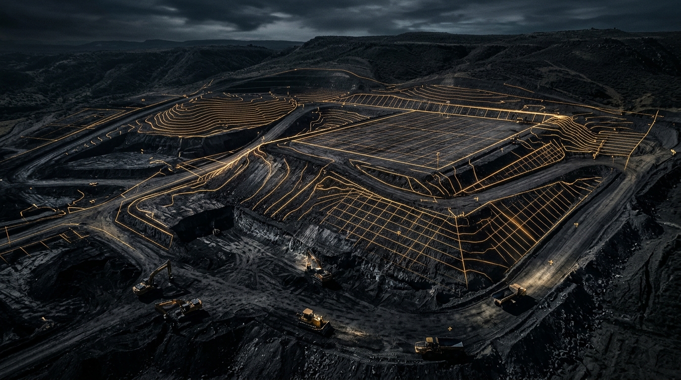
Jobsite with Civil CAD and Volumetric Cut Fill Overlay
CUT ZONE // -3.8 FT AVG VOL: 8,420 CY EXCAVATED FILL ZONE // +2.4 FT AVG VOL: 6,190 CY COMPACTED DETENTION BASIN // BTM 134.0' EXCAVATED: 11,640 CY VERIFIED EL +148.0' EL +146.0' BLDG PAD A // CAD OVERLAY VERIFIED FF ELEV: 148.50' • GRADE TOLERANCE: ±0.04' 24" RCP STORM // INV 138.2' STA 00+00 STA 04+50 STA 08+00 STA 11+50 STA 15+00 SP-01 // TOPSOIL 3,480 CY SP-02 // SELECT FILL 5,910 CY SP-03 // CLAY SPOIL 2,850 CY
LIVE CIVIL 3D CAD + CUT/FILL VOLUMETRICS
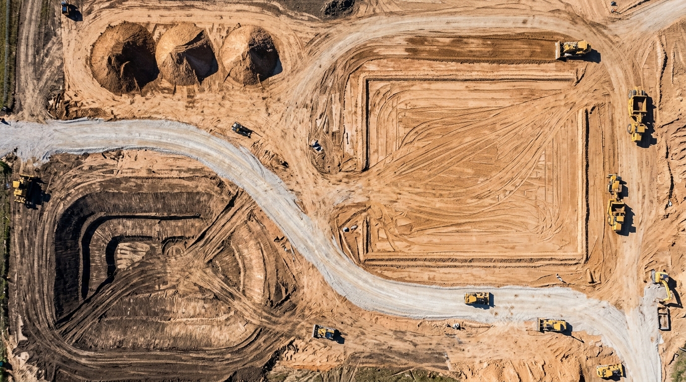
Raw Aerial Jobsite Orthomosaic
RAW SITE ORTHOMOSAIC (BEFORE CAD OVERLAY)
TOTAL CUT VOLUME 8,420 CY
TOTAL FILL VOLUME 6,190 CY
STOCKPILE INVENTORY (3 PILES) 12,240 CY
NET EARTHWORK BALANCE +2,230 CY EXPORT
PAY-APP AUDIT STATUS VERIFIED TO CAD
OPERATIONAL CAPABILITIES // BUILT FOR GCs, DEVELOPERS & DIRT CONTRACTORS

PROTECT YOUR SCHEDULE. VERIFY EVERY YARD.

01 // VOLUMETRICS

Dirt Work & Cut/Fill Volumetrics

Stop relying on truck-load tally sheets or rough estimates when approving earthwork pay applications. We calculate exact stockpile cubic yardages, borrow pit excavations, and site-wide cut/fill balances so you know to the yard how much material moved since the last scan.

  • Subcontractor earthmoving pay-app verification
  • Aggregate & select-fill stockpile audits
  • Color-coded Cut/Fill elevation heatmaps
02 // CAD OVERLAYS

Live Civil CAD Surface Overlays

Catch bust alignments while they are still dirt—not after concrete is poured. We overlay your engineer’s .DXF / Civil 3D grading plans, utility trenches, storm lines, and building pad footprints directly onto current site imagery so your team sees discrepancies immediately.

  • Instant pad, curb, & utility trench alignment checks
  • Retention basin & drainage slope verification
  • Zero specialized CAD software needed for your field crew
03 // PROGRESS MONITORING

Repeatable Construction Progress

Give project owners, investors, and off-site executives an indisputable visual record of the entire build. Scheduled weekly, bi-weekly, or milestone site maps keep everyone aligned without burning hours driving from jobsite to jobsite.

  • Time-stamped historical site progression archive
  • High-resolution maps shareable via a single link
  • Eliminates contractor dispute finger-pointing
DISPATCH & SCHEDULING // TX • LA • MS • AR

READY TO LOCK IN YOUR JOBSITE NUMBERS?

Reach out directly to Conner or William to schedule a site scan, set up recurring progress monitoring, or run a volumetric audit on an active dirt project.

TEXAS LOUISIANA MISSISSIPPI ARKANSAS
OPERATIONS // DIRECT LINE
Conner Collins
OPERATIONS // DIRECT LINE
William Champion
SECTOR 02 // WINTER HERD CENSUS & NATIONWIDE DEER SURVEYOR DELIVERABLES

TOTAL RANCH INVENTORY.
MILLION-DOLLAR DELIVERABLES.

Know every buck, doe, exotic, and sounder on your acreage with zero guesswork. We fly comprehensive winter wildlife population surveys across Texas, Louisiana, Mississippi, and Arkansas—and for fellow deer surveyors nationwide, we turn your raw flight pins and photos into custom-branded interactive ranch map deliverables under your own company name.

EXECUTIVE RANCH DOSSIER // SELF-CONTAINED CLIENT DELIVERABLE

WHAT OUR INTERACTIVE SURVEY MAP DELIVERABLE LOOKS LIKE

OPEN FULLSCREEN DEMO MAP
ABOVE GRID DELIVERABLE ENGINE // OAK RIDGE WHITETAILS LLC (1,174 ACRES • 53 WAYPOINTS • 108 OBSERVED)
Custom Species Shields Non-Typical, Typical Bucks, Does, Axis, Red Stag, Turkey & Hogs
Click-Pin Photo Lightbox Every pin opens high-res visual verification photos & GPS telemetry
True Whitetail B:D Ratio Automatic headcount tallies & instant species/sex filter bar
2-Page Printable PDF Dossier Built-in executive Species Population Report ready to print or save
NATIONWIDE B2B SERVICE FOR DEER SURVEYORS // BRANDED WITH YOUR COMPANY NAME

FELLOW DEER SURVEYORS:
YOU FLY THE RANCH. WE BUILD YOUR DELIVERABLE.

Stop spending hours after every winter flight wrestling with mapping software, matching photo filenames to pins, or handing high-paying ranch owners a boring spreadsheet and a messy Google Drive folder. Send us your raw flight data, and we build this exact interactive map and 2-page printable population report branded with your company name.

STEP 01

You Fly the Survey

Fly your client’s ranch just like you already do. Drop your color-coded waypoints and snap your visual verification photos during the flight.

STEP 02

Send Us Your Raw Files

Send us your property boundary file, your raw pinpoints (KML/CSV), your deer photos, and your company name & logo.

STEP 03

Deliver Under Your Brand

We send back a turnkey interactive map package with your company name at the top—ready to send to your rancher as a link or offline zip.

WHAT MOST SURVEYORS HAND CLIENTS
  • A cluttered Google Drive or Dropbox folder of unorganized JPGs
  • A static Excel sheet or basic tally table with no visual context
  • Raw KML files that force the landowner to install Google Earth
  • Hours of unpaid computer work after flying all night
WHAT YOU HAND THEM WITH US
  • Your Company Name & Logo locked into a custom executive dashboard
  • Interactive satellite map where clicking any pin opens that exact buck’s photo
  • One-click filters for Non-Typicals, Typical Bucks, Does, Exotics, Turkey & Hogs
  • 2-page printable Species Population PDF report + zero software needed on phone/iPad/PC
DIRECT FLIGHT OPERATIONS // TX • LA • MS • AR

WINTER RANCH SURVEYS FOR LANDOWNERS & MANAGERS

01 // HERD INVENTORY

True Population & Ratio Counts

Take the guesswork out of harvest quotas and wildlife management plans. We deliver accurate total headcounts, Whitetail Buck-to-Doe ratios, and age/antler class breakdowns across high-fence and low-fence properties.

02 // VISUAL VERIFICATION

Every Trophy Pin Photographed

Don’t settle for a dot on a map with no proof. We pair our detections with high-resolution visual photographs so you can inspect your mature Typical and Non-Typical bucks, Axis, and Red Stag right from the map.

03 // PREDATOR & HOG INTEL

Exotics, Turkey & Feral Hogs

Alongside your whitetail herd, we log and map feral hog sounders, Rio Grande & Eastern turkey flocks, and exotic game so you know exactly what is pressuring your feeders and habitat.

DIRECT CONTACT // RANCH SURVEYS & NATIONWIDE SURVEYOR DELIVERABLES

BOOK A RANCH SURVEY OR SEND US YOUR FLIGHT FILES

Landowners in TX, LA, MS, and AR: call or email to get on the winter flight schedule.
Deer Surveyors Nationwide: reach out directly to set up custom-branded deliverables for your ranch clients.

FLIGHTS: TX • LA • MS • AR B2B SURVEYOR DELIVERABLES: NATIONWIDE
OPERATIONS // DIRECT LINE
Conner Collins
OPERATIONS // DIRECT LINE
William Champion